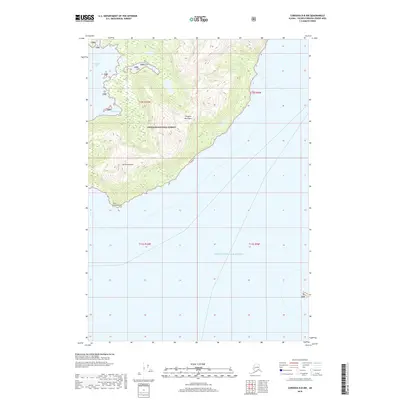
2018 Map of Cordova D-8 NW
USGS Topo · Published 2018About this map
Chugach National Forest encompasses the entirety of the terrestrial landscape on this coastal portion of South Central Alaska. The terrain is dominated by the steep, glaciated rises of the Chugach Mountains, which descend abruptly into the deep waters of Prince William Sound. This coastal interface is marked by significant topographical landmarks, including the prominent peak of Mt Freemantle and its southern extension at Point Freemantle. Along the western shoreline, the waters of Columbia Bay and the sheltered Jade Harbor suggest a coastline shaped by glacial activity and maritime influence. The lack of roads or established settlements on this sheet highlights the wilderness character of the region, where the landscape is defined by vertical relief and maritime access points rather than human infrastructure.
Find a feature on this map
12 named features on this map. Tap any name to fly to it.
Don’t see what you’re looking for? This feature index may not catch every label — zoom into the map to look around manually.
Map Details
Editions of this 2018 Cordova D-8 NW Map
This is the sole edition of this map. No revisions or reprints were ever made.
Other maps of this area

1948 · Cordova
USGS Topo · 1:250,000

1951 · Seward
USGS Topo · 1:250,000

1951 · Anchorage
USGS Topo · 1:250,000

1951 · Cordova
USGS Topo · 1:250,000

1951 · Seward D-1
USGS Topo · 1:63,360

1951 · Cordova D-8
USGS Topo · 1:63,360

1952 · Valdez
USGS Topo · 1:250,000

1952 · Seward D-1
USGS Topo · 1:63,360

1952 · Cordova D-8
USGS Topo · 1:63,360

1953 · Seward
USGS Topo · 1:250,000