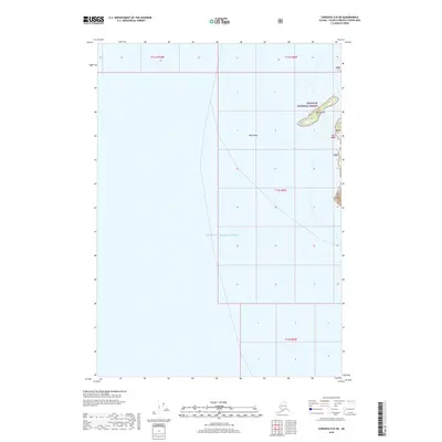
2018 Map of Cordova D-8 SW
USGS Topo · Published 2018About this map
Prince William Sound dominates this maritime survey, illustrating the treacherous waters and remote coastlines within the Chugach National Forest. The map is centered on Bligh Reef, a name synonymous with navigational history in these northern waters. Nearby, Reef Island provides one of the few terrestrial landmarks in an expanse otherwise defined by deep-water channels and rugged tidal zones. The survey detail focuses on the coastal interface, where the massive federal forest lands meet the open sound. This 2018 edition provides an exact record of the shoreline and submerged hazards as they were cataloged in the early 21st century, serving as a critical reference for understanding the geography of this specific Alaskan corridor.
Find a feature on this map
9 named features on this map. Tap any name to fly to it.
Don’t see what you’re looking for? This feature index may not catch every label — zoom into the map to look around manually.
Map Details
Editions of this 2018 Cordova D-8 SW Map
This is the sole edition of this map. No revisions or reprints were ever made.
Other maps of this area

1948 · Cordova
USGS Topo · 1:250,000

1950 · Cordova C-8
USGS Topo · 1:63,360

1951 · Seward
USGS Topo · 1:250,000

1951 · Cordova
USGS Topo · 1:250,000

1951 · Seward D-1
USGS Topo · 1:63,360

1951 · Cordova D-8
USGS Topo · 1:63,360

1951 · Seward C-1
USGS Topo · 1:63,360

1952 · Seward C-1
USGS Topo · 1:63,360

1952 · Seward D-1
USGS Topo · 1:63,360

1952 · Cordova D-8
USGS Topo · 1:63,360