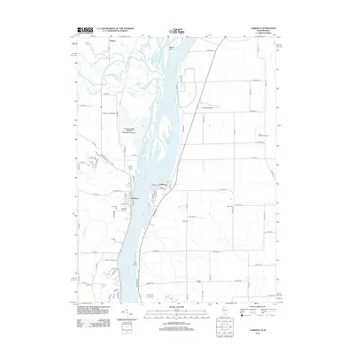
2012 Map of Cordova
USGS Topo · Published 2012About this map
The Mississippi River serves as the central artery for this riverfront landscape, dividing the settlements of Cordova and Princeton. On the western banks, the Princeton State Wildlife Management Area dominates the lowlands where the Wapsipinicon River and Rock Cr converge near Adams Island. The intricate network of waterways including Lost Cr and Bud Cr defines the local drainage, while the rural upland areas are dotted with family and municipal burial grounds such as Nowlin Cem, Oak Ridge Cem, and Baker Cem. This 2012 survey illustrates the intersection of recreation and industry, showing facilities like the Cordova Dragway, The Sandbox Airport, and Olathea Golf Course. Farther north, the small community of Folletts sits near the rail and road crossings that have historically connected these river towns.
Find a feature on this map
89 named features on this map. Tap any name to fly to it.
Don’t see what you’re looking for? This feature index may not catch every label — zoom into the map to look around manually.
Map Details
Editions of this 2012 Cordova Map
This is the sole edition of this map. No revisions or reprints were ever made.
Other maps of this area

1891 · Clinton
USGS Topo · 1:62,500

1892 · Goose Lake
USGS Topo · 1:62,500

1892 · Leclaire
USGS Topo · 1:62,500

1893 · Leclaire
USGS Topo · 1:62,500

1894 · Goose Lake
USGS Topo · 1:62,500

1894 · Clinton
USGS Topo · 1:62,500

1899 · Clinton
USGS Topo · 1:125,000

1949 · Silvis
USGS Topo · 1:24,000

1949 · Port Byron
USGS Topo · 1:24,000

1950 · Port Byron
USGS Topo · 1:24,000