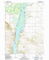
1991 Map of Cordova
USGS Topo · Published 1992About this map
The Mississippi River dominates this tri-county borderland, serving as the primary geographic divider between Iowa and Illinois. Along the eastern shore, industrial footprints like the Nuclear Powerplant and the Cordova Dragway contrast with the natural expanse of the Upper Mississippi River National Wild Life and Fish Refuge. The map reveals a dense network of local landmarks, from the riverfront settlements of Princeton and Cordova to more secluded points like Camp Hauberg further south. Genealogists will find significant value in the documented locations of family and community resting places, including Oak Ridge Cem, Baker Cem, and Nowlin Cem. The landscape transitions from the aquatic complexity of the Cordova Slough and Wapsipinicon River confluence to the organized agricultural grids of Coe and Port Byron townships.
Find a feature on this map
49 named features on this map. Tap any name to fly to it.
Don’t see what you’re looking for? This feature index may not catch every label — zoom into the map to look around manually.
Map Details
Editions of this 1991 Cordova Map
This is the sole edition of this map. No revisions or reprints were ever made.
Other maps of this area

1891 · Clinton
USGS Topo · 1:62,500

1892 · Goose Lake
USGS Topo · 1:62,500

1892 · Leclaire
USGS Topo · 1:62,500

1893 · Leclaire
USGS Topo · 1:62,500

1894 · Goose Lake
USGS Topo · 1:62,500

1894 · Clinton
USGS Topo · 1:62,500

1899 · Clinton
USGS Topo · 1:125,000

1949 · Silvis
USGS Topo · 1:24,000

1949 · Port Byron
USGS Topo · 1:24,000

1950 · Port Byron
USGS Topo · 1:24,000