
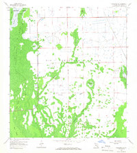
1958 Map of Corkscrew SE
USGS Topo · Published 1959About this map
Corkscrew Swamp Sanctuary anchors the northwest corner of this Collier County survey, representing a critical era of conservation in the Florida Everglades. The landscape is a complex mosaic of hydrologic features, dominated by the expansive Bird Rookery Swamp and the elevated terrain of Big Corkscrew Island. The map documents a transition in the wetlands, where natural drainage patterns like Winchester Strand and Poggie Strand meet early human interventions. Numerous Flowing Wells are plotted across the central sections, indicating groundwater exploration and the early agricultural footprints in this low-lying region. From the dense Shoggy Cypress Swamp to the distinctive outlines of Forth Island and Curry Island, the survey captures the intricate wilderness of south Florida before mid-century development and drainage projects significantly altered the regional water table.
Find a feature on this map
15 named features on this map. Tap any name to fly to it.
Don’t see what you’re looking for? This feature index may not catch every label — zoom into the map to look around manually.
Map Details
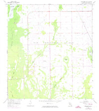
Editions of this 1958 Corkscrew SE Map
3 editions found
Other maps of this area

1956 · West Palm Beach
USGS Topo · 1:250,000

1957 · West Palm Beach
USGS Topo · 1:250,000

1958 · West Palm Beach
USGS Topo · 1:250,000

1958 · Corkscrew NW
USGS Topo · 1:24,000

1958 · Catherine Island
USGS Topo · 1:24,000

1958 · Immokalee
USGS Topo · 1:24,000

1958 · Belle Meade NE
USGS Topo · 1:24,000

1958 · Belle Meade NW
USGS Topo · 1:24,000

1958 · Immokalee SW
USGS Topo · 1:24,000

1958 · Corkscrew SW
USGS Topo · 1:24,000