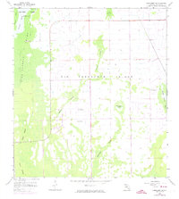
1958 Map of Corkscrew SE
USGS Topo · Published 1974About this map
The Corkscrew Swamp Sanctuary and the surrounding wetlands of Collier County dominate this landscape, mapped just as the region began seeing modern infrastructure revisions. The terrain is characterized by a complex network of strands and marshes, including the expansive Bird Rookery Swamp and Winchester Strand. While much of the area is seasonally inundated, elevated land features like Big Corkscrew Island, Forth Island, and Curry Island provided stable ground in an otherwise fluid environment.
Find a feature on this map
16 named features on this map. Tap any name to fly to it.
Don’t see what you’re looking for? This feature index may not catch every label — zoom into the map to look around manually.
Map Details
Editions of this 1958 Corkscrew SE Map
3 editions found
Other maps of this area

1956 · West Palm Beach
USGS Topo · 1:250,000

1957 · West Palm Beach
USGS Topo · 1:250,000

1958 · West Palm Beach
USGS Topo · 1:250,000

1958 · Corkscrew SE
USGS Topo · 1:24,000

1958 · Corkscrew NW
USGS Topo · 1:24,000

1958 · Catherine Island
USGS Topo · 1:24,000

1958 · Immokalee
USGS Topo · 1:24,000

1958 · Belle Meade NE
USGS Topo · 1:24,000

1958 · Belle Meade NW
USGS Topo · 1:24,000

1958 · Immokalee SW
USGS Topo · 1:24,000