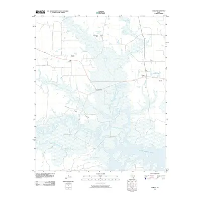
2010 Map of Corley
USGS Topo · Published 2010About this map
The Sulphur River and the vast expanse of Wright Patman Lake dominate this eastern Texas landscape, where the riparian environment transitions into the upland heights of White Oak Ridge. The 2010 geography reveals a mix of small rural settlements and extensive wetlands, particularly around Thomas Lake and the various tributaries like Panther Creek and Anderson Creek. Local history is anchored by several burial grounds including Old Union Cemetery, Mount Obie Cemetery, Berry Cemetery, and Irby Cemetery, which suggest the deep-rooted family lineages of the area. Transport and industry in this quadrangle are represented by a network of county roads and a Logging Rd, while aviation is marked by Ashford Field near Ashford Lake. Small communities such as Corley, Carbondale, and Old Union serve as the primary human nodes within this river-bottom and ridge topography.
Find a feature on this map
37 named features on this map. Tap any name to fly to it.
Don’t see what you’re looking for? This feature index may not catch every label — zoom into the map to look around manually.
Map Details
Editions of this 2010 Corley Map
This is the sole edition of this map. No revisions or reprints were ever made.
Other maps of this area

1909 · New Boston
USGS Topo · 1:62,500

1910 · Linden
USGS Topo · 1:62,500

1914 · Daingerfield
USGS Topo · 1:62,500

1930 · Bassett
USGS Topo · 1:62,500

1953 · Texarkana
USGS Topo · 1:250,000

1954 · New Boston
USGS Topo · 1:24,000

1954 · Hooks
USGS Topo · 1:24,000

1955 · Corley
USGS Topo · 1:24,000

1955 · Maud
USGS Topo · 1:24,000

1955 · New Boston
USGS Topo · 1:62,500