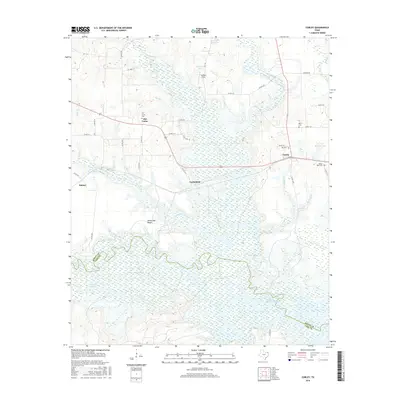
2016 Map of Corley
USGS Topo · Published 2016About this map
Wright Patman Lake and its extensive wetlands dominate the southern half of this Northeast Texas landscape, marking the boundary where Bowie Co meets Cass County. The area is defined by a network of small watercourses like Anderson Cr, Brooks Cr, and Panther Cr that feed into the larger reservoir system. Small rural settlements are scattered across the northern uplands, including Old Union and Carbondale, which serve as local hubs for the surrounding timber and agricultural lands.
Find a feature on this map
45 named features on this map. Tap any name to fly to it.
Don’t see what you’re looking for? This feature index may not catch every label — zoom into the map to look around manually.
Map Details
Editions of this 2016 Corley Map
This is the sole edition of this map. No revisions or reprints were ever made.
Other maps of this area

1909 · New Boston
USGS Topo · 1:62,500

1910 · Linden
USGS Topo · 1:62,500

1914 · Daingerfield
USGS Topo · 1:62,500

1930 · Bassett
USGS Topo · 1:62,500

1953 · Texarkana
USGS Topo · 1:250,000

1954 · New Boston
USGS Topo · 1:24,000

1954 · Hooks
USGS Topo · 1:24,000

1955 · Corley
USGS Topo · 1:24,000

1955 · Maud
USGS Topo · 1:24,000

1955 · New Boston
USGS Topo · 1:62,500