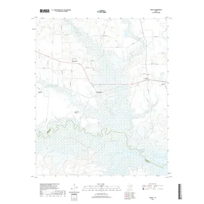
2019 Map of Corley
USGS Topo · Published 2019About this map
Wright Patman Lake and its intricate shoreline dominate the southern reaches of this landscape along the border of Bowie and Cass counties. The terrain is defined by a dense network of small tributaries like Panther Cr, Rice Cr, and Moss Cr that drain into the larger reservoir. Settlement patterns are concentrated along the northern transport corridors, where the small community of Corley sits at a junction near Crystal Springs Lake. This late 2010s survey shows a rural environment where land use is split between aviation at Ashford Field, logging operations, and quiet homesteads. Genealogists will find significant value in the documentation of several family-named burial grounds, including Old Union Cem, Berry Cem, and Kirby Cem, which are tucked away near established settlements like Old Union and Carbondale.
Find a feature on this map
43 named features on this map. Tap any name to fly to it.
Don’t see what you’re looking for? This feature index may not catch every label — zoom into the map to look around manually.
Map Details
Editions of this 2019 Corley Map
This is the sole edition of this map. No revisions or reprints were ever made.
Other maps of this area

1909 · New Boston
USGS Topo · 1:62,500

1910 · Linden
USGS Topo · 1:62,500

1914 · Daingerfield
USGS Topo · 1:62,500

1930 · Bassett
USGS Topo · 1:62,500

1953 · Texarkana
USGS Topo · 1:250,000

1954 · New Boston
USGS Topo · 1:24,000

1954 · Hooks
USGS Topo · 1:24,000

1955 · Corley
USGS Topo · 1:24,000

1955 · Maud
USGS Topo · 1:24,000

1955 · New Boston
USGS Topo · 1:62,500