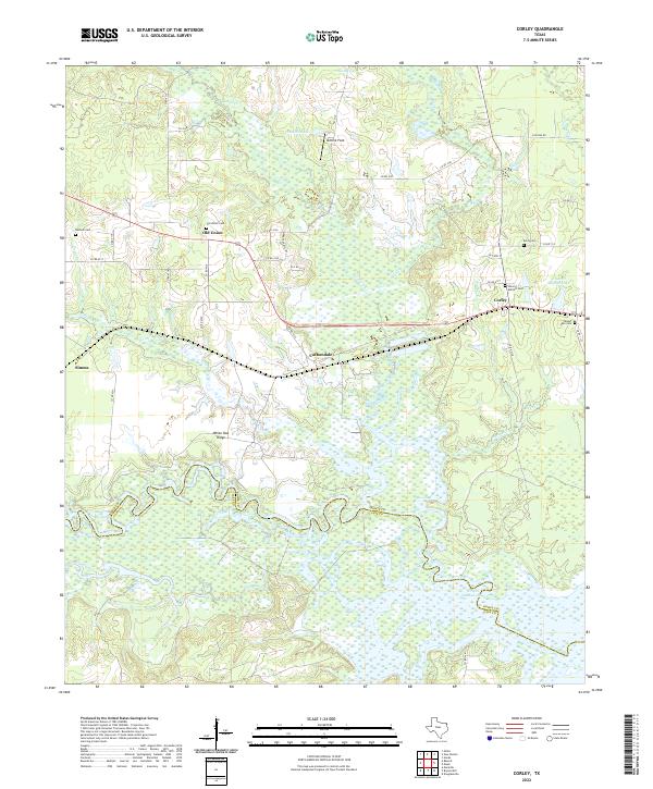
2022 Map of Corley
USGS Topo · Published 2022About this map
Sulphur River bottomlands define the southern landscape of this Bowie and Cass County borderland, where the river meanders through dense wetlands toward Wright Patman Lake. The settlement patterns here follow the higher ground of the interior, with small communities like Corley, Carbondale, and Old Union connected by a network of county roads. For those tracing family histories, the map identifies several distinct burial grounds, including the Old Union Cem and Sherrill - Burnett Cem near the eastern margin. The terrain transitions from the low-lying Brooks Cr and Panther Cr drainages up toward White Oak Ridge, reflecting a landscape dedicated to timber and rural life. North of Carbondale, the landscape opens up toward Ashford Lake and Ashford Field, providing a clear view of the area's modern rural character.
Find a feature on this map
51 named features on this map. Tap any name to fly to it.
Don’t see what you’re looking for? This feature index may not catch every label — zoom into the map to look around manually.
Map Details
Editions of this 2022 Corley Map
This is the sole edition of this map. No revisions or reprints were ever made.
Other maps of this area

1909 · New Boston
USGS Topo · 1:62,500

1910 · Linden
USGS Topo · 1:62,500

1914 · Daingerfield
USGS Topo · 1:62,500

1930 · Bassett
USGS Topo · 1:62,500

1953 · Texarkana
USGS Topo · 1:250,000

1954 · New Boston
USGS Topo · 1:24,000

1954 · Hooks
USGS Topo · 1:24,000

1955 · Corley
USGS Topo · 1:24,000

1955 · Maud
USGS Topo · 1:24,000

1955 · New Boston
USGS Topo · 1:62,500