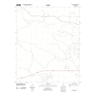
2010 Map of Corn Ranch
USGS Topo · Published 2010About this map
Corn Ranch sits at the northern edge of this 2010 landscape, where the Chaves County terrain begins its ascent toward Sixmile Hill in the southeast. This portion of New Mexico showcases a transitional pattern of land use, where traditional ranching geography meets emerging residential development. The northern reaches are defined by a network of rural routes such as Marly Rd and County Hwy-170, while the southern sector exhibits more modern planning. Drainage for the area is dominated by the intermittent winding course of Berrendo Creek. Near the southern border, the map reveals a more dense street grid including Tierra Grande Blvd, Las Flores Dr, and Palacio, illustrating the outward growth of residential infrastructure into the high plains landscape.
Find a feature on this map
18 named features on this map. Tap any name to fly to it.
Don’t see what you’re looking for? This feature index may not catch every label — zoom into the map to look around manually.
Map Details
Editions of this 2010 Corn Ranch Map
This is the sole edition of this map. No revisions or reprints were ever made.
Other maps of this area

1949 · Hondo Reservoir
USGS Topo · 1:24,000

1949 · Roswell North
USGS Topo · 1:24,000

1949 · Roswell South
USGS Topo · 1:24,000

1949 · Corn Ranch
USGS Topo · 1:24,000

1950 · Corn Ranch
USGS Topo · 1:24,000

1955 · Roswell
USGS Topo · 1:250,000

1956 · Diamond A Ranch
USGS Topo · 1:24,000

1958 · Roswell
USGS Topo · 1:250,000

1959 · Diamond A Ranch
USGS Topo · 1:24,000

1962 · Roswell
USGS Topo · 1:250,000