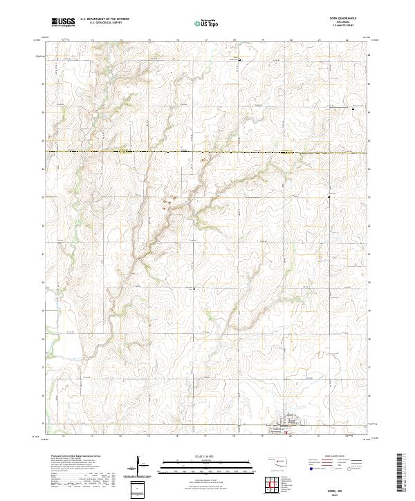
2022 Map of Corn
USGS Topo · Published 2022About this map
The town of Corn anchors the southern boundary of this landscape, where the street grid of Dewey St and Oklahoma St meets the open agricultural plains of the southern Great Plains. The area is defined by a dense network of country roads following the section lines, including E1070 Rd which follows the Custer Co Washita Co line. This grid is frequently interrupted by the winding paths of local waterways such as Bear Cr, Coffee Cr, and the Washita River in the southwest corner. For genealogists and local historians, the map is particularly useful for its preservation of rural landmarks, marking several distinct burial grounds that reflect the area's early settlement patterns. These include Zion Cem, Bergthal Cem, and South Cedar Cem, scattered among the township lines of t11n r15w and t12n r16w.
Find a feature on this map
45 named features on this map. Tap any name to fly to it.
Don’t see what you’re looking for? This feature index may not catch every label — zoom into the map to look around manually.
Map Details
Editions of this 2022 Corn Map
This is the sole edition of this map. No revisions or reprints were ever made.
Other maps of this area

1955 · Clinton
USGS Topo · 1:250,000

1956 · Cordell
USGS Topo · 1:62,500

1957 · Clinton
USGS Topo · 1:250,000

1957 · Clinton
USGS Topo · 1:62,500

1961 · Eakly
USGS Topo · 1:62,500

1964 · Weatherford
USGS Topo · 1:62,500

1976 · Clinton SE
USGS Topo · 1:24,000

1976 · Clinton SW
USGS Topo · 1:24,000
1983 · Bessie
USGS Topo · 1:24,000
1983 · Clinton
USGS Topo · 1:24,000