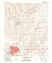
1983 Map of Clinton
USGS Topo · Published 1984About this map
The Washita River valley serves as the central corridor for this 1980s landscape, where the county seat at Arapaho and the larger trade center of Clinton anchor the region's development. Local government and civic life are concentrated around the Courthouse in Arapaho, while Clinton shows significant growth with its network of neighborhood parks such as McLain Rogers Park and Baker Park. The map documents a transition in Western Oklahoma's transportation history, showing the active rail infrastructure of the Farmrail and the Atchison Topeka and Northern Santa Fe lines.
Find a feature on this map
33 named features on this map. Tap any name to fly to it.
Don’t see what you’re looking for? This feature index may not catch every label — zoom into the map to look around manually.
Map Details
Editions of this 1983 Clinton Map
This is the sole edition of this map. No revisions or reprints were ever made.
Other maps of this area

1955 · Clinton
USGS Topo · 1:250,000

1956 · Cordell
USGS Topo · 1:62,500

1957 · Clinton
USGS Topo · 1:250,000

1957 · Butler
USGS Topo · 1:62,500

1957 · Clinton
USGS Topo · 1:62,500

1957 · Dill City
USGS Topo · 1:62,500

1976 · Clinton SE
USGS Topo · 1:24,000

1976 · Butler NE
USGS Topo · 1:24,000

1976 · Clinton SW
USGS Topo · 1:24,000

1976 · Clinton NW
USGS Topo · 1:24,000