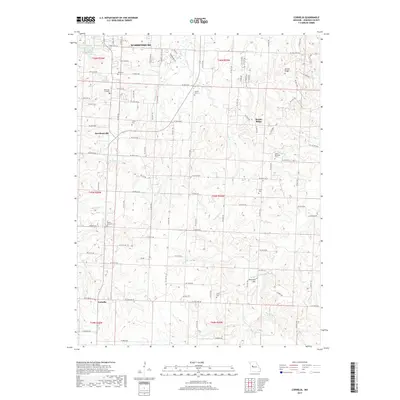
2017 Map of Cornelia
USGS Topo · Published 2017About this map
Warrensburg and its southern agricultural hinterland in Johnson County are defined by a complex network of small watercourses like W Bear Cr and Vinegar Br that cut through the rolling Missouri landscape. The southern reaches of the city extend toward Pertle Springs Lake, while the rural countryside is dotted with long-established family and community burial grounds, including Roop Cem, Fickas Cem, and the Sutton Cem.
Find a feature on this map
100 named features on this map. Tap any name to fly to it.
Don’t see what you’re looking for? This feature index may not catch every label — zoom into the map to look around manually.
Map Details
Editions of this 2017 Cornelia Map
This is the sole edition of this map. No revisions or reprints were ever made.
Other maps of this area

1885 · Warrensburg
USGS Topo · 1:125,000

1887 · Warrensburg
USGS Topo · 1:125,000

1894 · Warrensburg
USGS Topo · 1:125,000

1917 · Knobnoster
USGS Topo · 1:62,500

1947 · Jefferson City
USGS Topo · 1:250,000

1954 · Jefferson City
USGS Topo · 1:250,000

1954 · Centerview
USGS Topo · 1:24,000
1955 · Leeton
USGS Topo · 1:24,000
1955 · Windsor
USGS Topo · 1:24,000

1955 · Cornelia
USGS Topo · 1:24,000