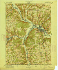
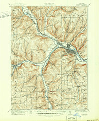
1914 Map of Corning
USGS Topo · Published 1914About this map
The Chemung River and its major tributaries, the Canisteo River and Tioga River, dictate the settlement patterns of this Steuben County landscape. The industrial and transit hub of Corning sits at the confluence, flanked by the village of Painted Post and the smaller enclave of Gibson. The 1914 topography reveals a complex network of competing rail lines, including the Erie Railroad, the Rochester Division, and the New York Central and Hudson River Railroad, which followed the river valleys to connect these manufacturing centers. Away from the valley floors, the hills are dotted with local institutions like the Green Hill School and Orr Hill School, alongside family-named landmarks such as French's Mill. The southern edge of the survey tracks the New York Pennsylvania Boundary Line, showing the rural character of communities like Lindley and Caton before the expansion of modern infrastructure.
Find a feature on this map
95 named features on this map. Tap any name to fly to it.
Don’t see what you’re looking for? This feature index may not catch every label — zoom into the map to look around manually.
Map Details
Editions of this 1914 Corning Map
6 editions found
Other maps of this area

1895 · Elmira
USGS Topo · 1:62,500

1898 · Watkins Glen
USGS Topo · 1:62,500

1900 · Tioga
USGS Topo · 1:62,500

1900 · Elkland
USGS Topo · 1:62,500

1901 · Watkins
USGS Topo · 1:62,500

1902 · Tioga
USGS Topo · 1:62,500

1903 · Hammondsport
USGS Topo · 1:62,500

1905 · Watkins Glen
USGS Topo · 1:125,000

1910 · Bath
USGS Topo · 1:62,500

1914 · Corning
USGS Topo · 1:62,500