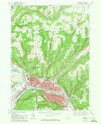
1969 Map of Corning
USGS Topo · Published 1971About this map
Corning stands at the confluence of the Cohocton River and the Tioga River, which merge here to form the Chemung River. This 1960s landscape shows the concentrated urban development of Riverside, Painted Post, and South Corning tightly clustered along the river valley floor. Beyond the city center, the terrain rises sharply into high ridges such as Denmark Hill and Corning Hill, where much of the land is preserved within State Forest boundaries. The area’s industrial and civic infrastructure is prominent, featuring the Penn Central railroad lines, several major schools like Northside Jr High Sch, and the central Courthouse and Hospital. The map also captures several rural settlements and family-named cemeteries, including Goodsell Cem and West Hill Cem, providing a detailed view of the valley's transition from an industrial river hub to upland forest.
Find a feature on this map
61 named features on this map. Tap any name to fly to it.
Don’t see what you’re looking for? This feature index may not catch every label — zoom into the map to look around manually.
Map Details
Editions of this 1969 Corning Map
Other maps of this area

1895 · Elmira
USGS Topo · 1:62,500

1898 · Watkins Glen
USGS Topo · 1:62,500

1901 · Watkins
USGS Topo · 1:62,500

1903 · Hammondsport
USGS Topo · 1:62,500

1905 · Watkins Glen
USGS Topo · 1:125,000

1914 · Corning
USGS Topo · 1:62,500

1944 · Corning
USGS Topo · 1:62,500

1950 · Elmira
USGS Topo · 1:250,000

1953 · Campbell
USGS Topo · 1:24,000

1953 · Bradford
USGS Topo · 1:24,000