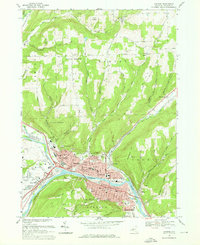
1969 Map of Corning
USGS Topo · Published 1976About this map
The Chemung River confluence serves as the industrial and civic heart of this Steuben County landscape, where the Tioga River and Cohocton River meet at Painted Post. This era of the late 1960s captures the transition of the regional rail economy, featuring the tracks of the Erie-Lackawanna and Penn Central railroads as they thread through Corning and Riverside. The urban core is densely marked with community landmarks, including the Memorial Stadium, Courthouse, and numerous neighborhood schools like Northside Jr High Sch and Phillips Sch.
Find a feature on this map
77 named features on this map. Tap any name to fly to it.
Don’t see what you’re looking for? This feature index may not catch every label — zoom into the map to look around manually.
Map Details
Editions of this 1969 Corning Map
Other maps of this area

1895 · Elmira
USGS Topo · 1:62,500

1898 · Watkins Glen
USGS Topo · 1:62,500

1901 · Watkins
USGS Topo · 1:62,500

1903 · Hammondsport
USGS Topo · 1:62,500

1905 · Watkins Glen
USGS Topo · 1:125,000

1914 · Corning
USGS Topo · 1:62,500

1944 · Corning
USGS Topo · 1:62,500

1950 · Elmira
USGS Topo · 1:250,000

1953 · Campbell
USGS Topo · 1:24,000

1953 · Bradford
USGS Topo · 1:24,000