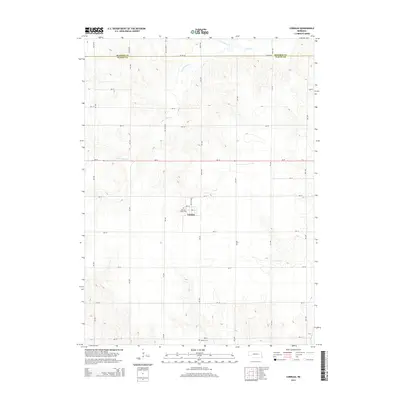
2014 Map of Cornlea
USGS Topo · Published 2014About this map
Cornlea sits at the heart of this agricultural landscape in Platte County, serving as a central hub where NE-71F-Spur meets local routes like 3rd St. The surrounding terrain is defined by the branching waterways of the Loup River system, including the N Fork Union Cr, S Fork Union Cr, and Union Cr which carve gentle valleys through the prairie. To the south, Tracy Cr and Elm Cr further drain the upland sections near the Madison County line. Local history is anchored by the presence of Sacred Heart Cem and Moriah Cem, markers of the area's rural settlement and the enduring family heritage of these Nebraska plains.
Find a feature on this map
33 named features on this map. Tap any name to fly to it.
Don’t see what you’re looking for? This feature index may not catch every label — zoom into the map to look around manually.
Map Details
Editions of this 2014 Cornlea Map
This is the sole edition of this map. No revisions or reprints were ever made.
Other maps of this area

1955 · Fremont
USGS Topo · 1:250,000

1957 · Fremont
USGS Topo · 1:250,000

1958 · Fremont
USGS Topo · 1:250,000

1963 · Madison
USGS Topo · 1:24,000

1963 · Battle Creek SE
USGS Topo · 1:24,000

1963 · Battle Creek SW
USGS Topo · 1:24,000

1966 · Tarnov
USGS Topo · 1:24,000
1966 · Lindsay SW
USGS Topo · 1:24,000

1966 · Platte Center
USGS Topo · 1:24,000
1966 · Lindsay
USGS Topo · 1:24,000