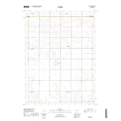
2017 Map of Cornlea
USGS Topo · Published 2017About this map
Cornlea serves as the central hub for this rural stretch along the border of Madison and Platte Counties. The settlement is anchored by the Sacred Heart Cem, situated just west of State Spur 71F. The landscape is defined by the drainage patterns of several tributaries, including Union Cr, the S Fork Union Cr, and Elm Cr, which carve through the agricultural sections and township lines. To the south, Moriah Cem sits near 400th St, providing an additional anchor for genealogical research in this sparsely populated region. The map reveals a rigid section-line road grid, where local routes like Central Hwy and Co Line Rd connect scattered farmsteads across the undulating Nebraska plains.
Find a feature on this map
28 named features on this map. Tap any name to fly to it.
Don’t see what you’re looking for? This feature index may not catch every label — zoom into the map to look around manually.
Map Details
Editions of this 2017 Cornlea Map
This is the sole edition of this map. No revisions or reprints were ever made.
Other maps of this area

1955 · Fremont
USGS Topo · 1:250,000

1957 · Fremont
USGS Topo · 1:250,000

1958 · Fremont
USGS Topo · 1:250,000

1963 · Madison
USGS Topo · 1:24,000

1963 · Battle Creek SE
USGS Topo · 1:24,000

1963 · Battle Creek SW
USGS Topo · 1:24,000

1966 · Tarnov
USGS Topo · 1:24,000
1966 · Lindsay SW
USGS Topo · 1:24,000

1966 · Platte Center
USGS Topo · 1:24,000
1966 · Lindsay
USGS Topo · 1:24,000