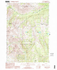
1990 Map of Cornucopia
USGS Topo · Published 1990About this map
Cornucopia sits at the heart of this high-elevation landscape, where the mining history of the Wallowa Mountains is etched into the terrain. The settlement is surrounded by significant industrial remnants, including the Queen of the West Mine, the Last Chance Mine, and the Coulter Tunnel, highlighting an era of intense resource extraction. The topography is defined by the sharp rise of Cornucopia Peak and Marble Mountain, with drainage provided by the South Fork Imnaha River and Pine Creek.
Find a feature on this map
42 named features on this map. Tap any name to fly to it.
Don’t see what you’re looking for? This feature index may not catch every label — zoom into the map to look around manually.
Map Details
Editions of this 1990 Cornucopia Map
2 editions found
Other maps of this area

1915 · Pine
USGS Topo · 1:125,000

1954 · Cornucopia
USGS Topo · 1:62,500

1954 · Eagle Cap
USGS Topo · 1:62,500

1955 · Baker
USGS Topo · 1:250,000

1955 · Grangeville
USGS Topo · 1:250,000

1957 · Halfway
USGS Topo · 1:62,500

1957 · Sparta
USGS Topo · 1:62,500

1959 · Baker
USGS Topo · 1:250,000

1959 · Grangeville
USGS Topo · 1:250,000

1981 · Baker
USGS Topo · 1:100,000