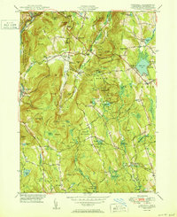
1950 Map of Cornwall
USGS Topo · Published 1950About this map
The Housatonic River corridor defines the western edge of this Litchfield County landscape, where the New York New Haven and Hartford RR traces the valley floor past West Cornwall and Cornwall Bridge. The 1950 terrain is characterized by a network of crossroad settlements including Cornwall Center, North Cornwall, and Kellogg Corners, connected by early routes through the Mohawk State Forest. Recreation and conservation are prominent, evidenced by the Appalachian Trail winding over Sharon Mountain and the presence of Camp Mohawk and the Shepherd Knapp Camp. Notable local landmarks like the Baldwin Cave and the Black Spruce Bog sit alongside family-named geography like Emmons Corners and Hitchcock Corners. The map also captures the topography of Mohawk Mountain featuring a Ski Lift and Lookout Tower, reflecting the area's mid-century role as a center for outdoor activity.
Find a feature on this map
106 named features on this map. Tap any name to fly to it.
Don’t see what you’re looking for? This feature index may not catch every label — zoom into the map to look around manually.
Map Details
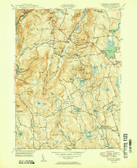
Editions of this 1950 Cornwall Map
2 editions found
Other maps of this area

1892 · Winsted
USGS Topo · 1:62,500

1892 · Cornwall
USGS Topo · 1:62,500

1892 · New Milford
USGS Topo · 1:62,500

1893 · Waterbury
USGS Topo · 1:62,500

1893 · New Milford
USGS Topo · 1:62,500

1893 · Cornwall
USGS Topo · 1:62,500

1903 · Cornwall
USGS Topo · 1:62,500

1904 · New Milford
USGS Topo · 1:62,500

1904 · Waterbury
USGS Topo · 1:62,500

1904 · Litchfield
USGS Topo · 1:125,000