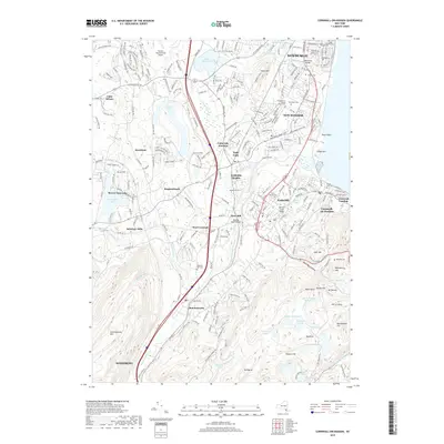
2019 Map of Cornwall-on-Hudson
USGS Topo · Published 2019About this map
Stewart International Airport anchors the northwestern corner of this Hudson Highlands landscape, a region where dense suburban development meets the steep, wooded slopes of the Appalachian range. The map documents the intricate hydrology of the area, from the sprawling Lake Washington and Beaverdam Lake to the high-elevation catchments of Aleck Meadow Reservoir and Sphagnum Pond. Significant residential expansion is evident across New Windsor and Vails Gate, while the southern reaches remain dominated by the massive ridge of Schunemunk Mtn.
Find a feature on this map
69 named features on this map. Tap any name to fly to it.
Don’t see what you’re looking for? This feature index may not catch every label — zoom into the map to look around manually.
Map Details
Editions of this 2019 Cornwall-on-Hudson Map
This is the sole edition of this map. No revisions or reprints were ever made.
Other maps of this area

1892 · West Point
USGS Topo · 1:62,500

1893 · Poughkeepsie
USGS Topo · 1:62,500

1894 · West Point
USGS Topo · 1:62,500

1894 · Poughkeepsie
USGS Topo · 1:62,500

1899 · West Point
USGS Topo · 1:62,500

1901 · West Point
USGS Topo · 1:62,500

1902 · Schunemunk
USGS Topo · 1:62,500

1903 · Poughkeepsie
USGS Topo · 1:62,500

1903 · Newburg
USGS Topo · 1:62,500

1930 · Schunemunk
USGS Topo · 1:48,000