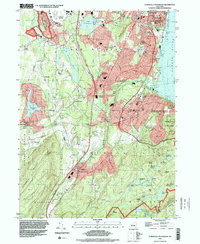
1994 Map of Cornwall-on-Hudson
USGS Topo · Published 2000About this map
Storm King State Park and the high ridges of Schunnemunk Mountain define the southwestern landscape of this Hudson Highlands quadrangle, where the Hudson River meets the steep slopes of Whitehorse Mtn and Butter Hill. This area is characterized by a dense concentration of military and educational institutions, most notably the U S Military Academy West Point grounds in the south and the Stewart Army Sub-Post near Stewart Airport in the north. The winding path of Moodna Creek connects the industrial and residential clusters of Firthcliffe and Salisbury Mills before reaching the riverside at Cornwall Landing. Historical sites like Knox Headquarters and the Temple Hill Monument sit among a landscape carved by the Catskill Aqueduct and the Conrail rail lines, reflecting the region's enduring importance as a corridor for defense, transportation, and water infrastructure for the state.
Find a feature on this map
92 named features on this map. Tap any name to fly to it.
Don’t see what you’re looking for? This feature index may not catch every label — zoom into the map to look around manually.
Map Details
Editions of this 1994 Cornwall-on-Hudson Map
This is the sole edition of this map. No revisions or reprints were ever made.
Other maps of this area

1892 · West Point
USGS Topo · 1:62,500

1893 · Poughkeepsie
USGS Topo · 1:62,500

1894 · West Point
USGS Topo · 1:62,500

1894 · Poughkeepsie
USGS Topo · 1:62,500

1899 · West Point
USGS Topo · 1:62,500

1901 · West Point
USGS Topo · 1:62,500

1902 · Schunemunk
USGS Topo · 1:62,500

1903 · Poughkeepsie
USGS Topo · 1:62,500

1903 · Newburg
USGS Topo · 1:62,500

1930 · Schunemunk
USGS Topo · 1:48,000