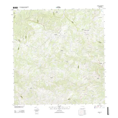
2013 Map of Corozal
USGS Topo · Published 2013About this map
Corozal and its surrounding mountain terrain are meticulously detailed in this early 21st-century topographic survey. The area is defined by a dense network of watercourses, including the Rio Cibuco and Rio Corozal, which carve through the Montañas de Corozal. The settlement pattern follows the steep topography, with major corridors like PR-159 and PR-164 connecting the central municipality to nearby Naranjito and smaller communities such as H. Rivera Colón. Local genealogy and land use are reflected in the numerous named caminos, such as Camino La Ceiba and Camino La Cuchilla, which likely correspond to long-standing family holdings and rural access routes. Notable landmarks like the Po (Post Office) and the peak of Cerro Santa Bárbara provide fixed points for understanding the geography of this central interior region of the Island of Puerto Rico.
Find a feature on this map
68 named features on this map. Tap any name to fly to it.
Don’t see what you’re looking for? This feature index may not catch every label — zoom into the map to look around manually.
Map Details
Editions of this 2013 Corozal Map
This is the sole edition of this map. No revisions or reprints were ever made.
Other maps of this area

1940 · Vega Alta
USGS Topo · 1:30,000

1941 · Bayamon
USGS Topo · 1:30,000

1942 · Manati
USGS Topo · 1:30,000

1946 · Corozal
USGS Topo · 1:30,000

1946 · Barranquitas
USGS Topo · 1:30,000

1946 · Ciales
USGS Topo · 1:30,000

1946 · Vega Alta
USGS Topo · 1:30,000

1946 · Comerio
USGS Topo · 1:30,000

1946 · Naranjito
USGS Topo · 1:30,000

1946 · Manati
USGS Topo · 1:30,000
Featured Places
- Corozal
- Benito Nieves (Los Quiles), Naranjito
- Sector El Winche, Toa Alta
- Reparto Los Cocos, Toa Alta
- Los López, Naranjito