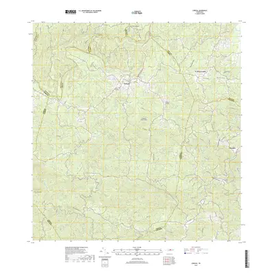
2018 Map of Corozal
USGS Topo · Published 2018About this map
Corozal sits at the heart of this landscape, where the Expreso De Corozal meets the winding Río Cibuco. The terrain is defined by the Montañas de Corozal, rising to peaks such as Cerro Santa Bárbara and Cerro Magueyes. This interior region of Puerto Rico shows a complex network of waterways, including the Río Grande de Manatí and Río Mavilla, which have historically dictated the placement of settlements and transport routes. To the east, the town of Naranjito anchors the map near the Río Guadiana. For those tracing local history, the map identifies specific locations such as the Cementerio Municipal de Corozal and the Pagan Memorial Cem, alongside the Corozal MTB Trail, illustrating the mix of traditional community centers and modern recreational development.
Find a feature on this map
34 named features on this map. Tap any name to fly to it.
Don’t see what you’re looking for? This feature index may not catch every label — zoom into the map to look around manually.
Map Details
Editions of this 2018 Corozal Map
This is the sole edition of this map. No revisions or reprints were ever made.
Other maps of this area

1940 · Vega Alta
USGS Topo · 1:30,000

1941 · Bayamon
USGS Topo · 1:30,000

1942 · Manati
USGS Topo · 1:30,000

1946 · Corozal
USGS Topo · 1:30,000

1946 · Barranquitas
USGS Topo · 1:30,000

1946 · Ciales
USGS Topo · 1:30,000

1946 · Vega Alta
USGS Topo · 1:30,000

1946 · Comerio
USGS Topo · 1:30,000

1946 · Naranjito
USGS Topo · 1:30,000

1946 · Manati
USGS Topo · 1:30,000
Featured Places
- Corozal
- Benito Nieves (Los Quiles), Naranjito
- Sector El Winche, Toa Alta
- Reparto Los Cocos, Toa Alta
- Los López, Naranjito