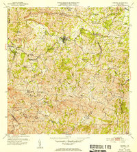
1953 Map of Corozal
USGS Topo · Published 1953About this map
Corozal and its central Pueblo district serve as the anchor for this 1953 topographic survey, which reveals the complex network of barrios and river systems in central Puerto Rico. The town's infrastructure is marked by the Acueducto de Corozal, while spiritual and educational centers like the Iglesia de la Inmaculada Concepción and the Escuela Vocacional Dr José Padín highlight the community's focal points. The landscape is deeply incised by the Río Cibuco and Río Mavilla, which wind through agricultural regions such as Candelaria and Padilla. Boundary lines for the Municipio de Corozal and neighboring Municipio de Vega Alta provide clear administrative context for researchers tracing local lineage. Notable landmarks like the Iglesia La Milagrosa in the south and various local schools, including Escuela Río Lajas, indicate a well-distributed rural population connected by growing roadways during the mid-century era.
Find a feature on this map
67 named features on this map. Tap any name to fly to it.
Don’t see what you’re looking for? This feature index may not catch every label — zoom into the map to look around manually.
Map Details
Editions of this 1953 Corozal Map
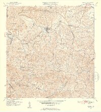
2 editions found
Other maps of this area

1940 · Vega Alta
USGS Topo · 1:30,000

1941 · Bayamon
USGS Topo · 1:30,000

1942 · Manati
USGS Topo · 1:30,000

1946 · Corozal
USGS Topo · 1:30,000

1946 · Barranquitas
USGS Topo · 1:30,000

1946 · Ciales
USGS Topo · 1:30,000

1946 · Vega Alta
USGS Topo · 1:30,000

1946 · Comerio
USGS Topo · 1:30,000

1946 · Naranjito
USGS Topo · 1:30,000

1946 · Manati
USGS Topo · 1:30,000
Featured Places
- Corozal
- Sunflower Valley, Toa Alta
- Los Pelusa, Naranjito
- Reparto Pérez, Toa Alta
- Sector Rolo Barrera, Corozal