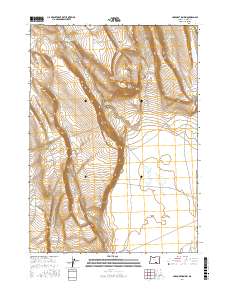
2017 Map of Corporation Rim
USGS Topo · Published 2017About this map
Corporation Rim dominates this high desert landscape in Harney County, defining a sharp escarpment that overlooks the western edge of the Warner Valley. This 2017 survey illustrates the complex water management required in such an arid environment, where isolated catchments like Corporation Lake, Knob Reservoir, and Wagon Reservoir serve as vital resources. The terrain is marked by distinctive geological formations including the Three Story Rim and the prominence of Black Cap. Stock water infrastructure is evident through named features like the Bacon Camp Waterhole and North Desert Waterhole, connected by a network of forest development roads such as Nat For Dev Rd 6155. These labels suggest a landscape shaped by ranching interests and seasonal grazing within the Great Basin's drainage patterns.
Find a feature on this map
25 named features on this map. Tap any name to fly to it.
Don’t see what you’re looking for? This feature index may not catch every label — zoom into the map to look around manually.
Map Details
Editions of this 2017 Corporation Rim Map
This is the sole edition of this map. No revisions or reprints were ever made.
Other maps of this area

1955 · Adel
USGS Topo · 1:250,000

1957 · Adel
USGS Topo · 1:250,000

1958 · Adel
USGS Topo · 1:250,000

1962 · Adel
USGS Topo · 1:250,000

1966 · Bluejoint Lake East
USGS Topo · 1:24,000

1966 · Rabbit Hills NE
USGS Topo · 1:24,000

1967 · Bluejoint Lake West
USGS Topo · 1:24,000

1971 · Steamboat Point
USGS Topo · 1:24,000

1971 · Rock Camp Draw
USGS Topo · 1:24,000
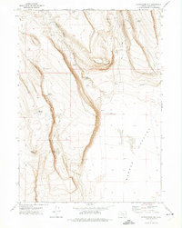
1971 · Corporation Rim
USGS Topo · 1:24,000