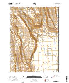
2020 Map of Corporation Rim
USGS Topo · Published 2020About this map
Corporation Rim dominates this high desert landscape, carving a distinct geological edge through Harney County. The distribution of vital water resources in this arid environment is clearly documented, from the Corporation Lake near the rim's base to specialized catchments like Bacon Camp Waterhole and North Desert Waterhole. These features, along with Gamble Reservoir and Wagon Reservoir, underscore the critical infrastructure required for land management and ranching in the region.
Find a feature on this map
26 named features on this map. Tap any name to fly to it.
Don’t see what you’re looking for? This feature index may not catch every label — zoom into the map to look around manually.
Map Details
Editions of this 2020 Corporation Rim Map
This is the sole edition of this map. No revisions or reprints were ever made.
Other maps of this area

1955 · Adel
USGS Topo · 1:250,000

1957 · Adel
USGS Topo · 1:250,000

1958 · Adel
USGS Topo · 1:250,000

1962 · Adel
USGS Topo · 1:250,000

1966 · Bluejoint Lake East
USGS Topo · 1:24,000

1966 · Rabbit Hills NE
USGS Topo · 1:24,000

1967 · Bluejoint Lake West
USGS Topo · 1:24,000

1971 · Steamboat Point
USGS Topo · 1:24,000

1971 · Rock Camp Draw
USGS Topo · 1:24,000
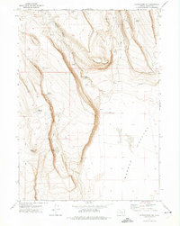
1971 · Corporation Rim
USGS Topo · 1:24,000