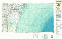
1989 Map of Corpus Christi
USGS Topo · Published 1991About this map
Corpus Christi Bay and the extensive barrier island systems of the Texas Gulf Coast dominate this topographic-bathymetric study. The map illustrates a region heavily shaped by military presence and coastal industry, notably featuring the Corpus Christi Naval Air Station and Kingsville Naval Air Station, alongside commercial infrastructure like the Texas Mexican RR. Beyond the urban centers, the landscape transitions into the preserved stretches of the Padre Island National Seashore and Mustang Island State Park. The intricate hydrography of the region is documented in detail, from the inland reaches of Baffin Bay and Cayo del Grullo to the bathymetric contours of the Gulf of Mexico. Smaller communities such as Vattmannville, Petronila, and Loyola Beach provide essential reference points for local history, while landmarks like the University of Corpus Christi and various regional airports trace the late 20th-century development of Nueces Bay and the surrounding South Texas coastal plain.
Find a feature on this map
105 named features on this map. Tap any name to fly to it.
Don’t see what you’re looking for? This feature index may not catch every label — zoom into the map to look around manually.
Map Details
Editions of this 1989 Corpus Christi Map
This is the sole edition of this map. No revisions or reprints were ever made.
Other maps of this area

1917 · Ben Bolt
USGS Topo · 1:62,500

1920 · Mikeska
USGS Topo · 1:125,000

1920 · San Diego
USGS Topo · 1:62,500

1921 · Falfurrias
USGS Topo · 1:125,000

1923 · Armstrong
USGS Topo · 1:62,500

1923 · Lopena Island
USGS Topo · 1:62,500

1923 · Saltillo Ranch
USGS Topo · 1:62,500

1924 · Petronilla
USGS Topo · 1:62,500

1925 · Robstown
USGS Topo · 1:62,500

1925 · Aransas Pass
USGS Topo · 1:62,500