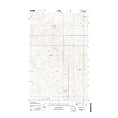
2014 Map of Corral Butte
USGS Topo · Published 2014About this map
Okanogan National Forest defines this high-elevation landscape in Okanogan County, characterized by a network of seasonal camps and expansive alpine meadows. The high ground of Corral Butte and Thunder Mtn overlooks a drainage system where Queer Cr and Wildhorse Cr flow north, while the various forks of Twentymile Cr and Toats Coulee Cr carve through the southern and eastern reaches.
Find a feature on this map
36 named features on this map. Tap any name to fly to it.
Don’t see what you’re looking for? This feature index may not catch every label — zoom into the map to look around manually.
Map Details
Editions of this 2014 Corral Butte Map
This is the sole edition of this map. No revisions or reprints were ever made.
Other maps of this area

1906 · Chopaka
USGS Topo · 1:125,000

1954 · Okanogan
USGS Topo · 1:250,000

1955 · Concrete
USGS Topo · 1:250,000

1956 · Tiffany Mountain
USGS Topo · 1:62,500

1956 · Horseshoe Basin
USGS Topo · 1:62,500

1958 · Concrete
USGS Topo · 1:250,000

1958 · Okanogan
USGS Topo · 1:250,000

1962 · Concrete
USGS Topo · 1:250,000

1963 · Doe Mountain
USGS Topo · 1:62,500
1969 · Coleman Peak
USGS Topo · 1:24,000