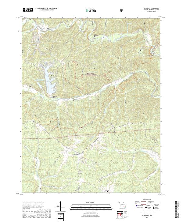
2021 Map of Corridon
USGS Topo · Published 2021About this map
West Fork, Reynolds, and Corridon anchor this section of the Mark Twain National Forest in the early 2020s. The landscape is defined by a dense network of hollows, including West Fork Hollow, Grasshopper Hollow, and Jourdan Hollow, which channel numerous watercourses toward the West Fork Black River. In the northern section, industrial activity is marked by the Fletcher Mine Clarification Basin near Number 46 Lake, illustrating the intersection of natural resources and land management in this timber-heavy region.
Find a feature on this map
57 named features on this map. Tap any name to fly to it.
Don’t see what you’re looking for? This feature index may not catch every label — zoom into the map to look around manually.
Map Details
Editions of this 2021 Corridon Map
This is the sole edition of this map. No revisions or reprints were ever made.
Other maps of this area

1924 · Edgehill
USGS Topo · 1:62,500

1926 · Edgehill
USGS Topo · 1:62,500

1943 · Lesterville
USGS Topo · 1:62,500

1943 · Boss
USGS Topo · 1:62,500

1944 · Corridon
USGS Topo · 1:62,500

1946 · Lesterville
USGS Topo · 1:62,500

1946 · Boss
USGS Topo · 1:62,500

1947 · Corridon
USGS Topo · 1:62,500

1949 · Rolla
USGS Topo · 1:250,000

1953 · Rolla
USGS Topo · 1:250,000