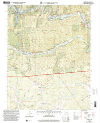
1999 Map of Corridon
USGS Topo · Published 2002About this map
The Black River and its West Fork dominate this terrain in the Salem Ranger District, where the timber and mining industries have shaped the landscape. Evidence of local production is found at the Charcoal Ovens near Reynolds, while industrial scale is present at the Fletcher Mine and its associated Tailings Pond. The map serves as a vital record for genealogists, documenting several community hubs such as the Corridon-Reynolds Sch and religious centers like Bee Fork Ch and Full Gospel Ch.
Find a feature on this map
48 named features on this map. Tap any name to fly to it.
Don’t see what you’re looking for? This feature index may not catch every label — zoom into the map to look around manually.
Map Details
Editions of this 1999 Corridon Map
This is the sole edition of this map. No revisions or reprints were ever made.
Other maps of this area

1924 · Edgehill
USGS Topo · 1:62,500

1926 · Edgehill
USGS Topo · 1:62,500

1943 · Lesterville
USGS Topo · 1:62,500

1943 · Boss
USGS Topo · 1:62,500

1944 · Corridon
USGS Topo · 1:62,500

1946 · Lesterville
USGS Topo · 1:62,500

1946 · Boss
USGS Topo · 1:62,500

1947 · Corridon
USGS Topo · 1:62,500

1949 · Rolla
USGS Topo · 1:250,000

1953 · Rolla
USGS Topo · 1:250,000