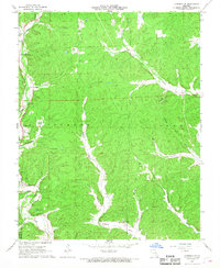
1967 Map of Corridon SE
USGS Topo · Published 1968About this map
Logan Creek meanders through the northwest corner of this terrain, where small farmsteads and family burial grounds dot the narrow valleys of the Missouri Ozarks in the mid-1960s. The settlement of Dickens serves as a local landmark in the southern reaches, situated along Dickens Valley near the Dickens Valley Ch. The geography is defined by a dense network of hollows, including Dry Valley, Snake Den Hollow, and Schrum Hollow, illustrating the intricate drainage patterns into the local creek systems.
Find a feature on this map
33 named features on this map. Tap any name to fly to it.
Don’t see what you’re looking for? This feature index may not catch every label — zoom into the map to look around manually.
Map Details
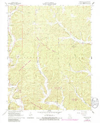
Editions of this 1967 Corridon SE Map
2 editions found
Other maps of this area

1928 · Cardareva
USGS Topo · 1:62,500

1943 · Ellington
USGS Topo · 1:62,500

1943 · Lesterville
USGS Topo · 1:62,500

1944 · Corridon
USGS Topo · 1:62,500

1945 · Ellington
USGS Topo · 1:62,500

1946 · Lesterville
USGS Topo · 1:62,500

1947 · Corridon
USGS Topo · 1:62,500

1949 · Rolla
USGS Topo · 1:250,000

1949 · Cardareva
USGS Topo · 1:62,500

1953 · Rolla
USGS Topo · 1:250,000