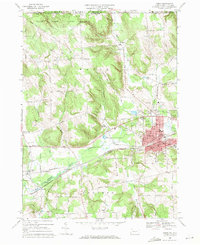
1968 Map of Corry
USGS Topo · Published 1971About this map
The industrial hub of Corry serves as the focal point of this 1968 field-checked survey, positioned at the critical junction of the Penn Central and Erie-Lackawanna railroads. The map illustrates a landscape transitioning from the dense urban grid of the city, complete with its Armory, City Hall, and Corry Area High Sch, to the surrounding dairy and agricultural lands of Wayne and Concord townships. The drainage of French Creek and its tributaries, such as Hare Creek and South Branch French Creek, dictates the placement of early settlements like Elgin and Lovell.
Find a feature on this map
74 named features on this map. Tap any name to fly to it.
Don’t see what you’re looking for? This feature index may not catch every label — zoom into the map to look around manually.
Map Details
Editions of this 1968 Corry Map
3 editions found
Other maps of this area

1905 · Clymer
USGS Topo · 1:62,500

1913 · North East
USGS Topo · 1:62,500

1915 · North East
USGS Topo · 1:62,500

1929 · Corry
USGS Topo · 1:48,000

1929 · Union City
USGS Topo · 1:62,500

1932 · Corry
USGS Topo · 1:62,500

1932 · Union City
USGS Topo · 1:62,500

1939 · Clymer
USGS Topo · 1:62,500

1941 · Clymer
USGS Topo · 1:62,500

1943 · North East
USGS Topo · 1:62,500