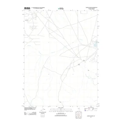
2012 Map of Cortez Canyon
USGS Topo · Published 2012About this map
Cortez Canyon and Copper Canyon define the high-desert character of this Lander County terrain, where elevation and drainage patterns dictate the sparse human footprint. The map documents isolated landmarks such as Francis Cabin in the south and Rock House to the east, indicating the long-standing use of these canyons for ranching or prospecting. These individual dwellings, along with the drainage of Cooks Creek, provide specific points of reference in a landscape otherwise marked by the prominent height of Squaw Butte. The network of local roads and 4WD tracks shown here reveals how modern travelers and land managers navigate this portion of the Great Basin, connecting remote outposts to the wider region.
Find a feature on this map
6 named features on this map. Tap any name to fly to it.
Don’t see what you’re looking for? This feature index may not catch every label — zoom into the map to look around manually.
Map Details
Editions of this 2012 Cortez Canyon Map
This is the sole edition of this map. No revisions or reprints were ever made.
Other maps of this area

1938 · Cortez
USGS Topo · 1:48,000

1944 · Cortez
USGS Topo · 1:62,500

1949 · Crescent Valley
USGS Topo · 1:62,500

1949 · Mt. Lewis
USGS Topo · 1:62,500

1950 · Mt. Lewis
USGS Topo · 1:62,500

1950 · Crescent Valley
USGS Topo · 1:62,500

1955 · Winnemucca
USGS Topo · 1:250,000

1958 · Winnemucca
USGS Topo · 1:250,000

1962 · Winnemucca
USGS Topo · 1:250,000

1962 · Carico Lake
USGS Topo · 1:62,500