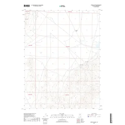
2018 Map of Cortez Canyon
USGS Topo · Published 2018About this map
Crescent Valley sits at the northern edge of this high-desert landscape in Lander County, where the transition from the broad valley floor to the steep slopes of the northern Shoshone Range is sharply defined. The settlement pattern here is sparse, characterized by a grid of rural roads and section lines typical of the Great Basin's modern development. To the south, the terrain becomes increasingly complex as the land rises toward the heights of Squaw Butte. This area is defined by its deep drainages and mineral potential, notably within the recesses of Cortez Canyon and Copper Canyon. The seasonal flow of Cooks Cr provides a rare water source through the valley, highlighting the geographic isolation and specialized industrial and ranching character of this Nevada interior.
Find a feature on this map
11 named features on this map. Tap any name to fly to it.
Don’t see what you’re looking for? This feature index may not catch every label — zoom into the map to look around manually.
Map Details
Editions of this 2018 Cortez Canyon Map
This is the sole edition of this map. No revisions or reprints were ever made.
Other maps of this area

1938 · Cortez
USGS Topo · 1:48,000

1944 · Cortez
USGS Topo · 1:62,500

1949 · Crescent Valley
USGS Topo · 1:62,500

1949 · Mt. Lewis
USGS Topo · 1:62,500

1950 · Mt. Lewis
USGS Topo · 1:62,500

1950 · Crescent Valley
USGS Topo · 1:62,500

1955 · Winnemucca
USGS Topo · 1:250,000

1958 · Winnemucca
USGS Topo · 1:250,000

1962 · Winnemucca
USGS Topo · 1:250,000

1962 · Carico Lake
USGS Topo · 1:62,500