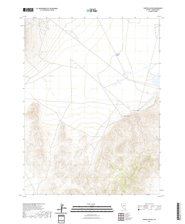
2021 Map of Cortez Canyon
USGS Topo · Published 2021About this map
Crescent Valley occupies the northern expanse of this Lander County landscape, where the flat valley floor meets the rising elevations of the southern mountains. The terrain is defined by dramatic geological formations, most notably the deep incisions of Cortez Canyon and Copper Canyon as they carve through the high ground. Drainage in the area is sparse, primarily traced by the ephemeral course of Cooks Cr, which winds through the northeastern sections. This 2021 survey illustrates the stark transition between the developed valley basin and the high-relief canyon systems that dominate the southern half of the quadrangle, highlighting the distinct topography that has historically shaped movement and settlement in this part of Nevada.
Find a feature on this map
10 named features on this map. Tap any name to fly to it.
Don’t see what you’re looking for? This feature index may not catch every label — zoom into the map to look around manually.
Map Details
Editions of this 2021 Cortez Canyon Map
This is the sole edition of this map. No revisions or reprints were ever made.
Other maps of this area

1938 · Cortez
USGS Topo · 1:48,000

1944 · Cortez
USGS Topo · 1:62,500

1949 · Crescent Valley
USGS Topo · 1:62,500

1949 · Mt. Lewis
USGS Topo · 1:62,500

1950 · Mt. Lewis
USGS Topo · 1:62,500

1950 · Crescent Valley
USGS Topo · 1:62,500

1955 · Winnemucca
USGS Topo · 1:250,000

1958 · Winnemucca
USGS Topo · 1:250,000

1962 · Winnemucca
USGS Topo · 1:250,000

1962 · Carico Lake
USGS Topo · 1:62,500