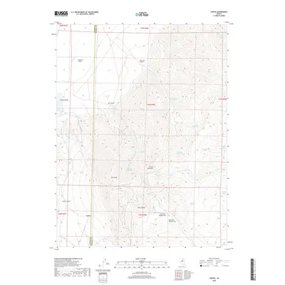
2018 Map of Cortez
USGS Topo · Published 2018About this map
The settlement of Cortez lies at the foot of the Cortez Mountains in this high-desert Nevada landscape, where the boundary between Lander Co and Eureka Co bisects the terrain. Rising to a prominent summit, Mt Tenabo overlooks a network of deep drainages including Cortez Canyon, Mill Canyon, and Fourmile Canyon. The map reveals a land defined by its scarce water sources, dotted with remote watering points like Buckhorn Spring, Sidehill Blue Spring, and Rimrock Springs.
Find a feature on this map
37 named features on this map. Tap any name to fly to it.
Don’t see what you’re looking for? This feature index may not catch every label — zoom into the map to look around manually.
Map Details
Editions of this 2018 Cortez Map
This is the sole edition of this map. No revisions or reprints were ever made.
Other maps of this area

1938 · Cortez
USGS Topo · 1:48,000

1944 · Cortez
USGS Topo · 1:62,500

1949 · Crescent Valley
USGS Topo · 1:62,500

1950 · Crescent Valley
USGS Topo · 1:62,500

1955 · Winnemucca
USGS Topo · 1:250,000

1957 · Frenchie Creek
USGS Topo · 1:62,500

1957 · Horse Creek Valley
USGS Topo · 1:62,500

1958 · Winnemucca
USGS Topo · 1:250,000

1962 · Winnemucca
USGS Topo · 1:250,000
1985 · Hand-Me-Down Creek
USGS Topo · 1:24,000