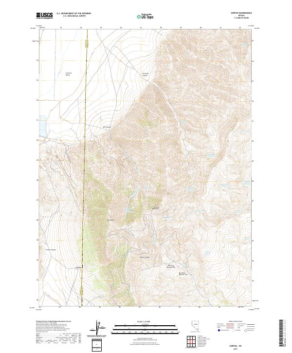
2021 Map of Cortez
USGS Topo · Published 2021About this map
Mt Tenabo anchors this high-elevation landscape where the Cortez Mountains meet the vast drainage of Crescent Valley. The map centers on the historical mining area of Cortez, situated at the intersection of the Lander Co Eureka Co line. The terrain is characterized by a complex network of canyons and springs, indicating a region where water sources were vital for early mountain settlement and operations. Notable corridors like Horse Canyon and Fourmile Canyon cut through the range, while features such as Big Field Number One and Big Field Number Two suggest specific sites of activity on the flatter high-ground plateaus.
Find a feature on this map
37 named features on this map. Tap any name to fly to it.
Don’t see what you’re looking for? This feature index may not catch every label — zoom into the map to look around manually.
Map Details
Editions of this 2021 Cortez Map
This is the sole edition of this map. No revisions or reprints were ever made.
Other maps of this area

1938 · Cortez
USGS Topo · 1:48,000

1944 · Cortez
USGS Topo · 1:62,500

1949 · Crescent Valley
USGS Topo · 1:62,500

1950 · Crescent Valley
USGS Topo · 1:62,500

1955 · Winnemucca
USGS Topo · 1:250,000

1957 · Frenchie Creek
USGS Topo · 1:62,500

1957 · Horse Creek Valley
USGS Topo · 1:62,500

1958 · Winnemucca
USGS Topo · 1:250,000

1962 · Winnemucca
USGS Topo · 1:250,000
1985 · Hand-Me-Down Creek
USGS Topo · 1:24,000