
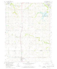
1964 Map of Cortland
USGS Topo · Published 1965About this map
Cortland and Princeton serve as the primary hubs in this mid-1960s agricultural portrait of the Nebraska plains, positioned along the Union Pacific railroad line. The landscape is defined by the headwaters of several drainages, including the Middle Branch Big Nemaha River and Salt Creek, which carve across township blocks like Buda, South Pass, and Centerville. A significant water feature, Stagecoach Lake, is identified as a State Recreation Area with a normal pool elevation of 1271 feet.
Find a feature on this map
27 named features on this map. Tap any name to fly to it.
Don’t see what you’re looking for? This feature index may not catch every label — zoom into the map to look around manually.
Map Details
Editions of this 1964 Cortland Map
2 editions found
Other maps of this area

1897 · Lincoln
USGS Topo · 1:125,000

1955 · Lincoln
USGS Topo · 1:250,000

1957 · Lincoln
USGS Topo · 1:250,000

1957 · Clatonia
USGS Topo · 1:24,000

1958 · Lincoln
USGS Topo · 1:250,000

1964 · Pickrell
USGS Topo · 1:24,000
1964 · Hallam
USGS Topo · 1:24,000

1964 · Denton
USGS Topo · 1:24,000

1964 · Roca
USGS Topo · 1:24,000

1965 · Adams
USGS Topo · 1:24,000