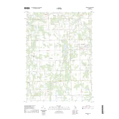
2023 Map of Corunna SE
USGS Topo · Published 2023About this map
Bancroft stands at the northern edge of this landscape, where the Shiawassee River and Grub Creek wind through a region defined by its rural crossroads and agricultural heritage. The boundary between Shiawassee Co and Livingston Co bisects the map, passing just north of the Conway Antrim Baptist Cemetery. This area is characterized by its numerous small lakes and managed waterways, including Merrill Lake, Euler Lake, and the complex drainage system of the Kanause Drain.
Find a feature on this map
83 named features on this map. Tap any name to fly to it.
Don’t see what you’re looking for? This feature index may not catch every label — zoom into the map to look around manually.
Map Details
Editions of this 2023 Corunna SE Map
This is the sole edition of this map. No revisions or reprints were ever made.
Other maps of this area

1907 · Howell
USGS Topo · 1:62,500

1908 · Fowlerville
USGS Topo · 1:62,500

1909 · Howell
USGS Topo · 1:62,500

1910 · Fowlerville
USGS Topo · 1:62,500

1922 · Durand
USGS Topo · 1:62,500

1926 · Corunna
USGS Topo · 1:62,500

1929 · Corunna
USGS Topo · 1:62,500

1943 · Durand
USGS Topo · 1:62,500

1944 · Corunna
USGS Topo · 1:62,500

1954 · Detroit
USGS Topo · 1:250,000