
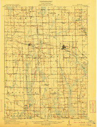
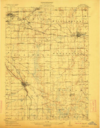
1926 Map of Corunna
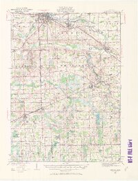
USGS Topo · Published 1958About this map
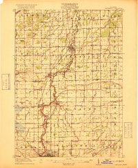
The Shiawassee River and Maple River define the northern drainage of this mid-Michigan landscape, where the neighboring industrial centers of Owosso and Corunna serve as the primary hubs of activity. During the mid-1920s, the region was heavily reliant on a sophisticated transportation network including the Grand Trunk, Ann Arbor, and Michigan Central railroads. A rare technological artifact of this era, the Michigan Electric line, cuts southwest through Morrice and Perry, representing the peak of the interurban railway era before the dominance of the automobile. Local agriculture and rural life are documented through a dense distribution of one-room schoolhouses like McCall Sch and Lytle Sch, while the presence of the Coal Mine Drain near Corunna hints at the area’s early sub-surface extraction history. Further south, the terrain softens into a lake district featuring Merrill Lake, Ward Lake, and the distinctive Hog Island.
Find a feature on this map
89 named features on this map. Tap any name to fly to it.
Don’t see what you’re looking for? This feature index may not catch every label — zoom into the map to look around manually.
Map Details
Editions of this 1926 Corunna Map
2 editions found
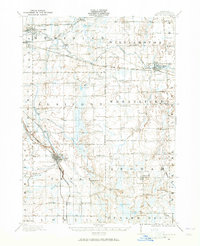
Other maps of this area

1907 · Howell
USGS Topo · 1:62,500

1908 · Fowlerville
USGS Topo · 1:62,500

1909 · Howell
USGS Topo · 1:62,500
1909 · Mason
USGS Topo · 1:62,500
1910 · Fowlerville
USGS Topo · 1:62,500
1911 · Mason
USGS Topo · 1:62,500
1917 · Chesaning
USGS Topo · 1:62,500

1918 · Elsie
USGS Topo · 1:62,500

1919 · Burt
USGS Topo · 1:62,500

1921 · Burt
USGS Topo · 1:62,500