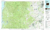
1980 Map of Corvallis
USGS Topo · Published 1981About this map
Marys Peak stands as a prominent landmark in the Coast Range, anchoring this 1980 survey of the diverse landscape between the Willamette Valley and the Pacific shore. The map details the transition from the timber-rich Siuslaw National Forest to the fertile agricultural lands along the Willamette River, where the Pacific Highway West and Southern Pacific railroad connect established centers like Corvallis and Monmouth. Along the coast, the geography is defined by rugged headlands and estuaries such as Yaquina Bay at Newport and the narrow inlet of Depoe Bay. Significant conservation areas, including the Baskett Slough National Wildlife Refuge and Ankeny National Wildlife Refuge, highlight the importance of the valley's wetlands. This edition captures the region's transport network just as modern development began to intensify around the university town of Corvallis and the coastal corridor of Lincoln City.
Find a feature on this map
139 named features on this map. Tap any name to fly to it.
Don’t see what you’re looking for? This feature index may not catch every label — zoom into the map to look around manually.
Map Details
Editions of this 1980 Corvallis Map
This is the sole edition of this map. No revisions or reprints were ever made.
Other maps of this area

1911 · Brownsville
USGS Topo · 1:31,680

1911 · Lebanon
USGS Topo · 1:31,680

1911 · Tangent
USGS Topo · 1:31,680

1911 · Inavale
USGS Topo · 1:31,680

1912 · Jefferson
USGS Topo · 1:31,680

1912 · Halsey
USGS Topo · 1:62,500

1913 · Philomath
USGS Topo · 1:31,680

1913 · Oakville
USGS Topo · 1:31,680

1913 · Wells
USGS Topo · 1:31,680

1914 · Independence
USGS Topo · 1:31,680