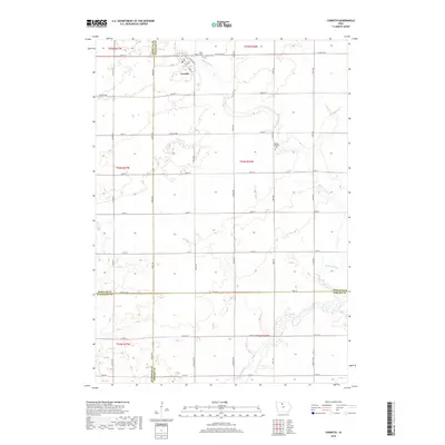
2018 Map of Corwith
USGS Topo · Published 2018About this map
The town of Corwith serves as the focal point for this section of north-central Iowa, situated near the intersection of Ames Ave and Co Hwy B55. The landscape is defined by the winding course of the Boone River, which carves through the prairie terrain in the northern and eastern sections of the quadrangle. For those researching family history, several prominent burial grounds are documented, including Saint Mary's Cem and Corwith Cem just outside the town limits, along with the Magor Township Cem further to the east. The map captures the highly structured section-line road network typical of the region's agricultural heritage, with routes like Co Rd R14 and Echo Ave providing the grid for local farms. This 2018 survey reveals the persistent township structure across the borders of Kossuth, Hancock, Humboldt, and Wright counties.
Find a feature on this map
43 named features on this map. Tap any name to fly to it.
Don’t see what you’re looking for? This feature index may not catch every label — zoom into the map to look around manually.
Map Details
Editions of this 2018 Corwith Map
This is the sole edition of this map. No revisions or reprints were ever made.
Other maps of this area

1954 · Fairmont
USGS Topo · 1:250,000

1954 · Mason City
USGS Topo · 1:250,000

1954 · Waterloo
USGS Topo · 1:250,000

1954 · Fort Dodge
USGS Topo · 1:250,000

1955 · Waterloo
USGS Topo · 1:250,000

1957 · Fort Dodge
USGS Topo · 1:250,000

1957 · Mason City
USGS Topo · 1:250,000

1958 · Mason City
USGS Topo · 1:250,000

1958 · Fort Dodge
USGS Topo · 1:250,000

1958 · Fairmont
USGS Topo · 1:250,000