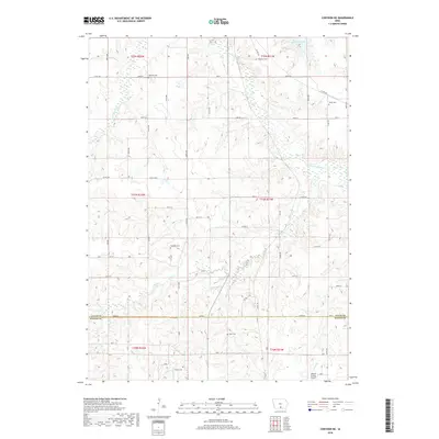
2018 Map of Corydon NE
USGS Topo · Published 2018About this map
Red Haw Lake occupies the northeastern corner of this Southern Iowa landscape, where the Chariton River and its tributaries define the undulating terrain of the Lucas Co and Wayne Co border. The map reveals a persistent rural structure marked by small, scattered settlements such as Watrous and Vale, connected by a grid of section-line roads like Co Rd H50 and Co Rd S23. Genealogists will find significant value in the distribution of family and community burial grounds across the townships, including Douglass Cem, Salem Cem, and Sharon Cem. The southern reach of the survey is punctuated by the Moore Private Airport near the headwaters of Lost Br, illustrating the integration of modern transit into a traditional agricultural landscape defined by Wolf Cr and Sugar Cr.
Find a feature on this map
40 named features on this map. Tap any name to fly to it.
Don’t see what you’re looking for? This feature index may not catch every label — zoom into the map to look around manually.
Map Details
Editions of this 2018 Corydon NE Map
This is the sole edition of this map. No revisions or reprints were ever made.
Other maps of this area

1918 · Chariton
USGS Topo · 1:62,500

1924 · Melcher
USGS Topo · 1:62,500

1934 · Humeston
USGS Topo · 1:48,000

1935 · Russell
USGS Topo · 1:62,500

1937 · Corydon
USGS Topo · 1:62,500

1938 · Russell
USGS Topo · 1:62,500

1954 · Centerville
USGS Topo · 1:250,000

1954 · Des Moines
USGS Topo · 1:250,000

1956 · Des Moines
USGS Topo · 1:250,000

1957 · Des Moines
USGS Topo · 1:250,000