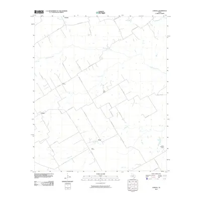
2010 Map of Coryell
USGS Topo · Published 2010About this map
The Middle Bosque River and its numerous tributaries, including Castle Creek and Cave Creek, carve a branching drainage pattern across this Central Texas landscape. Near the rural crossroads of Osage, the Osage Cemetery serves as a local landmark, while to the northwest, the Sadler Cemetery and the Prairie Chapel School indicate the historical social centers of this ranching and farming community. The small settlements of Coryell and Mosheim anchor the western and northern edges of the quadrangle, connected by a network of county roads like Bohne Rd and Coryell City Rd. This survey documents the region's transition from early pioneer settlement towards modern land uses, exemplified by the Flying ND Ranch Airport in the southeast corner. The terrain is defined by the persistent flow of Bluff Creek and Tonk Creek through the limestone-based geography of the Bosque river system.
Find a feature on this map
40 named features on this map. Tap any name to fly to it.
Don’t see what you’re looking for? This feature index may not catch every label — zoom into the map to look around manually.
Map Details
Editions of this 2010 Coryell Map
This is the sole edition of this map. No revisions or reprints were ever made.
Other maps of this area

1888 · Meridian
USGS Topo · 1:125,000

1892 · Temple
USGS Topo · 1:125,000

1892 · Waco
USGS Topo · 1:125,000

1894 · Meridian
USGS Topo · 1:125,000

1894 · Gatesville
USGS Topo · 1:125,000

1920 · Waco
USGS Topo · 1:125,000

1931 · Valley Mills
USGS Topo · 1:62,500

1931 · Mc Gregor
USGS Topo · 1:62,500

1947 · Oglesby
USGS Topo · 1:24,000

1947 · Gatesville East
USGS Topo · 1:24,000