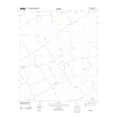
2012 Map of Coryell
USGS Topo · Published 2012About this map
Osage and Mosheim anchor this rural landscape in central Texas, where the drainage patterns of the Middle Bosque River and Bluff Cr dictate the settlement and road network. This 2012 survey reveals a country infrastructure built around family and community landmarks, including the Sadler Cem and Osage Cem. The distribution of farm-to-market roads and county lanes, such as Coryell City Rd and Prairie Chapel Rd, reflects a long-standing agricultural tradition that persists in the early 21st century. Local education and religious history are preserved through labels like the Prairie Chapel School and Canaan Church Rd, providing a detailed look at the social fabric of the unincorporated communities of Coryell and its neighbors. The terrain is marked by numerous seasonal and perennial watercourses, including Castle Cr, Tonk Cr, and Hog Cr, which define the property boundaries and travel routes of the county.
Find a feature on this map
55 named features on this map. Tap any name to fly to it.
Don’t see what you’re looking for? This feature index may not catch every label — zoom into the map to look around manually.
Map Details
Editions of this 2012 Coryell Map
This is the sole edition of this map. No revisions or reprints were ever made.
Other maps of this area

1888 · Meridian
USGS Topo · 1:125,000

1892 · Temple
USGS Topo · 1:125,000

1892 · Waco
USGS Topo · 1:125,000

1894 · Meridian
USGS Topo · 1:125,000

1894 · Gatesville
USGS Topo · 1:125,000

1920 · Waco
USGS Topo · 1:125,000

1931 · Valley Mills
USGS Topo · 1:62,500

1931 · Mc Gregor
USGS Topo · 1:62,500

1947 · Oglesby
USGS Topo · 1:24,000

1947 · Gatesville East
USGS Topo · 1:24,000