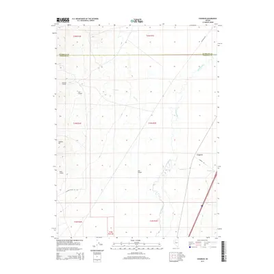
2014 Map of Cosgrave
USGS Topo · Published 2014About this map
Humboldt River winds through the Great Basin landscape of northern Nevada, serving as the central geographic feature for this area north of the Humboldt Co Pershing Co line. The terrain is characterized by a series of drainages and named canyons that feed into the river valley, including Central Cr and Raspberry Cr. The small settlement of Cosgrave sits near the eastern edge of the quadrangle, connected to the wider region by Cosgrave Rd. Higher elevations are marked by landmarks such as Florence Hill and the deep cuts of Cole Canyon and Pole Canyon. This modern survey details the vital transportation and infrastructure network of the high desert, from the industrial path of Pipeline Line Rd to the remote access provided by Keystone Canyon Rd.
Find a feature on this map
20 named features on this map. Tap any name to fly to it.
Don’t see what you’re looking for? This feature index may not catch every label — zoom into the map to look around manually.
Map Details
Editions of this 2014 Cosgrave Map
This is the sole edition of this map. No revisions or reprints were ever made.
Other maps of this area

1931 · Lovelock
USGS Topo · 1:250,000

1932 · Sonoma Range
USGS Topo · 1:250,000

1935 · Lovelock
USGS Topo · 1:250,000

1939 · Sonoma Range
USGS Topo · 1:250,000

1939 · Eugene Mountains Area
USGS Topo · 1:62,500

1942 · Eugene Mountains Area
USGS Topo · 1:62,500

1955 · Lovelock
USGS Topo · 1:250,000

1955 · Winnemucca
USGS Topo · 1:250,000

1956 · Imlay
USGS Topo · 1:62,500

1958 · Winnemucca
USGS Topo · 1:250,000