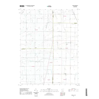
2019 Map of Cosmos
USGS Topo · Published 2019About this map
The Salamonie River, Mississinewa River, and the headwaters of the Wabash River converge across this borderland of Indiana and Ohio. This area, spanning portions of Jay and Randolph Counties in Indiana and Mercer and Darke Counties in Ohio, is defined by an intricate network of drainage ditches such as Peden Ditch and Sheffer Ditch that support the region's agricultural productivity. The settlement of Salem sits near the western edge, while Cosmos serves as a landmark at the junction of Co Hwy 38 and Gray Br. Genealogists will find several burial sites preserved across the landscape, including the Pleasant Ridge Cem near Twin Willows Lake and the Hoover Cem along the Mississinewa River. The map illustrates the transition from the Stillwater River basin in the south to the northern river systems, connected by a rigid grid of rural routes like E Treaty Line Rd.
Find a feature on this map
99 named features on this map. Tap any name to fly to it.
Don’t see what you’re looking for? This feature index may not catch every label — zoom into the map to look around manually.
Map Details
Editions of this 2019 Cosmos Map
This is the sole edition of this map. No revisions or reprints were ever made.
Other maps of this area

1908 · St. Henry
USGS Topo · 1:62,500

1915 · Fort Recovery
USGS Topo · 1:48,000

1916 · Winchester
USGS Topo · 1:48,000

1918 · Winchester
USGS Topo · 1:62,500

1918 · Fort Recovery
USGS Topo · 1:62,500

1943 · Winchester
USGS Topo · 1:62,500

1953 · Muncie
USGS Topo · 1:250,000

1956 · Muncie
USGS Topo · 1:250,000

1960 · Union City
USGS Topo · 1:24,000

1960 · Fort Recovery
USGS Topo · 1:24,000