
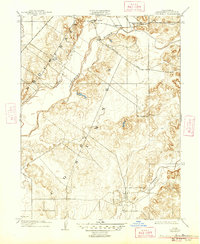
1909 Map of Cosumnes
USGS Topo · Published 1909About this map
Cosumnes River defines the central topography of this Sacramento County landscape, winding through a territory of alluvial plains and low-rising hills. This survey, conducted in cooperation with the State of California, captures the agricultural character of the region during a period of steady rural settlement. The northern border is punctuated by the established stage stop at Slough House and the small community of Cosumne, both situated along the path of Jackson Road.
Find a feature on this map
10 named features on this map. Tap any name to fly to it.
Don’t see what you’re looking for? This feature index may not catch every label — zoom into the map to look around manually.
Map Details
Editions of this 1909 Cosumnes Map
2 editions found
Other maps of this area

1891 · Sacramento
USGS Topo · 1:125,000

1892 · Sacramento
USGS Topo · 1:125,000

1893 · Sacramento
USGS Topo · 1:125,000

1894 · Lodi
USGS Topo · 1:125,000

1902 · Fairoaks
USGS Topo · 1:62,500

1908 · Buffalo Creek
USGS Topo · 1:31,680

1909 · Elk Grove
USGS Topo · 1:31,680

1909 · Carbondale
USGS Topo · 1:31,680

1909 · Clay
USGS Topo · 1:31,680

1909 · Goose Creek
USGS Topo · 1:31,680